January 29, 2018
Environmental Design, Visualisations
Commonly used in planning and Environmental Impact Assessment (EIA), the aim of verified visual montages (VVM), or also sometimes called Accurate Visual Representations (AVR), is to impartially represent proposed development as it would be expected to appear in reality. Alison Carroll and Chris Hale examine their role and some of the technical considerations when considering their use.
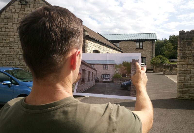
Whilst drawings such as plans, sections and elevations are a standard requirement in planning applications, not everyone can interpret them. Images that show a proposal accurately within its setting can greatly assist interpretation by both professionals and lay people.
Earlier in the process, accurately visualising the development within its context can also assist at the design stage. It can help embed mitigation with the definition of appropriate development parameters, such as height and massing, and selection of materials.
A VVM is distinct from other forms of visual representation; it is, as the name suggests, a verifiable image. The view is created from a defined ‘real’ location and not from an imagined perspective as can be the case with some sketches or computer generated images. The image is created using quantifiable data which can then be used by others to scrutinise the work without its veracity being questioned. This makes verified views particularly valuable in planning, for example as part of the EIA process, in public consultation, planning committees and at public inquiry.
VVMs use a baseline of verifiable visual information and combine photographic views with accurate CAD 3-D representation of the proposals to an agreed level of detail. There is a range of technical guidance available to inform their preparation, including:
- Landscape Institute, 2011. Photography and Photomontage in Landscape and Visual Impact Assessment. Advice Note 01/11.
- Landscape Institute and IEMA, 2013. Guidelines for Landscape and Visual Impact Assessment. Third Edition (GLVIA3).
- Landscape Institute, 2017. Visual Representation of Development. Technical Guidance Note 02/17.
- Greater London Authority (GLA), 2012. London View Management Framework Supplementary Planning Guidance. Appendix C: Accurate Visual Representations.
- Scottish Natural Heritage (SNH), 2016. Assessing the Impact of Small-Scale Wind Energy Proposals on the Natural Heritage. Version 3.
- SNH, 2017. Visual Representation of Wind Farms. Version 2.2.
When producing VVMs, a number of options are available to aid design and planning decisions according to the level of detail required. They can be classified to broadly define their purpose in terms of the visual properties they represent. The following classification, derived from guidance produced by the GLA (2012), is a cumulative scale in which each level incorporates all of the properties of the previous level. The levels are referred to as Accurate Visual Representation (AVR) Levels 0, 1, 2 and 3 as illustrated in Figure 1.
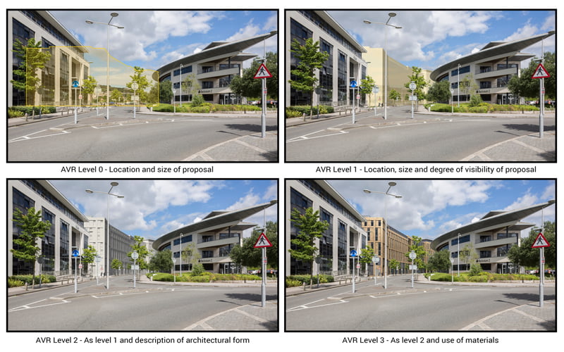
Block models (AVR Level 0) can be helpful early in the design process to test massing and scale, especially in sensitive viewpoints. The final model (AVR Level 3) can then have materials and textures added and colour rendered as required. Real-world lighting is created and cameras are positioned using accurate survey and mapping.
The Landscape Institute (2017) notes the importance of selecting types of visualisation which are appropriate in the circumstances for which they will be used. The need for a proportionate and reasonable approach to the scope of assessments is also advocated: a key principle of GLVIA3. Equally, the use of inappropriate forms of visualisation that do not accurately represent a proposed development can have a detrimental effect on planning outcomes.
Much of the data required to produce VVMs is now often routinely available within development planning teams, including accurate site survey and mapping and 3D CAD models of the development proposals. This can then be supplemented with high quality photography taken to exacting standards.
Case study: Pinesgate, Bath
Pinesgate, within the Bath World Heritage Site (WHS), was allocated as a site for mixed-use development including retail, offices, leisure and residential. In 2015, a planning application for an office building on one half of the site was refused because the building height and materials would have a detrimental impact on the WHS.
A revised scheme, incorporating offices, a college building and student accommodation, was designed with the aid of VVMs. The VVMs were also used in the EIA, in the public consultation exercise and in discussion by the planning committee. Feedback from members indicated that the VVMs were very helpful in allowing an understanding of the proposal. The scheme was approved.
This article was written in January 2018 as a contribution to the EIA Quality Mark’s commitment to improving EIA practice. Alison Carroll is an Associate at Nicholas Pearson Associates and is a Full Members of IEMA, a Chartered Environmentalist and a Registered EIA Practitioner. Chris Hale is also an Associate at Nicholas Pearson Associates.