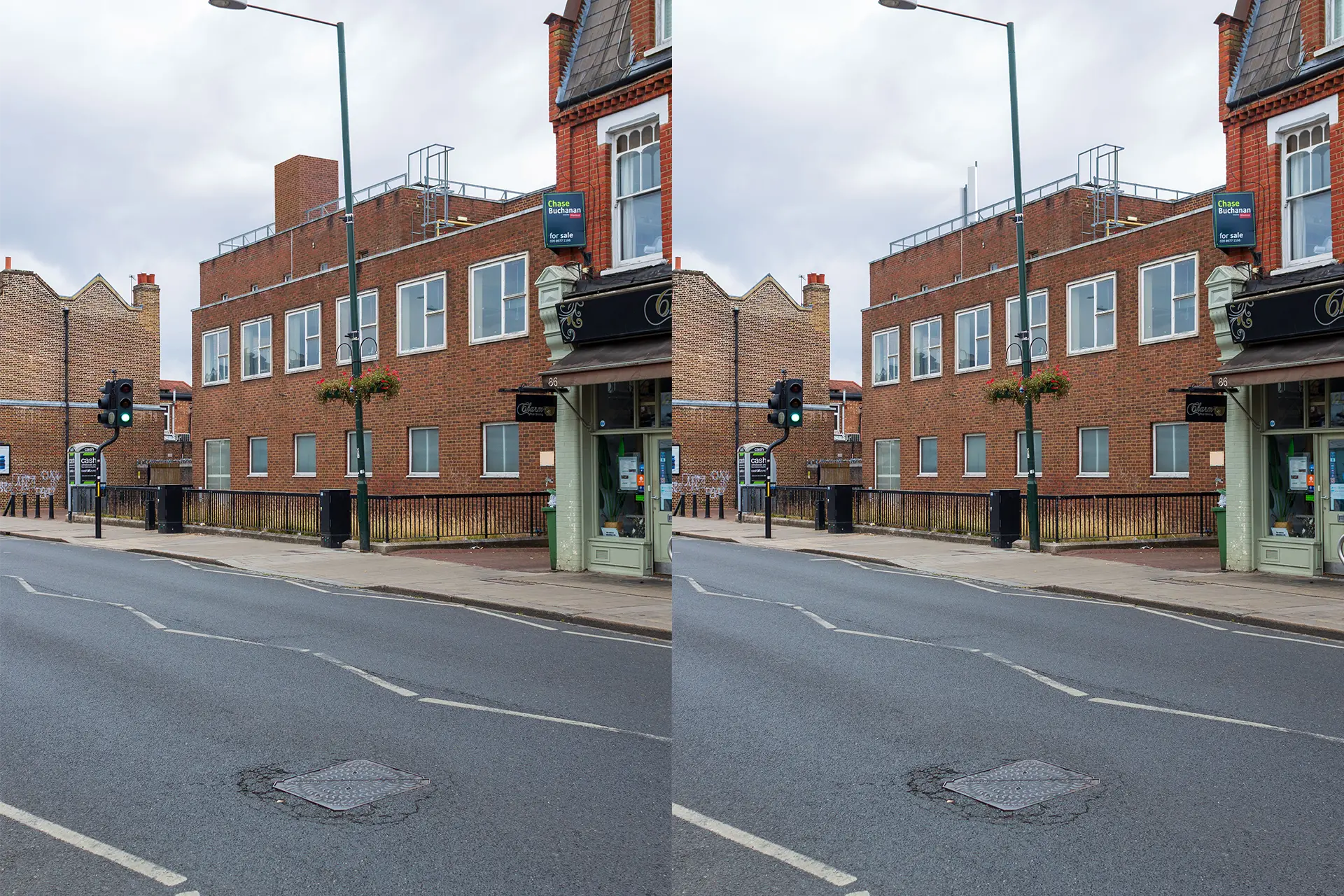
Cellnex UK, are providing 25 years of mobile signal improvements for Network Rail. NPAVisuals were asked to prepare Landscape Institute type 3 Accurate Visual Representations in support of the various planning applications for their London to Brighton Network Infrastructure Project.
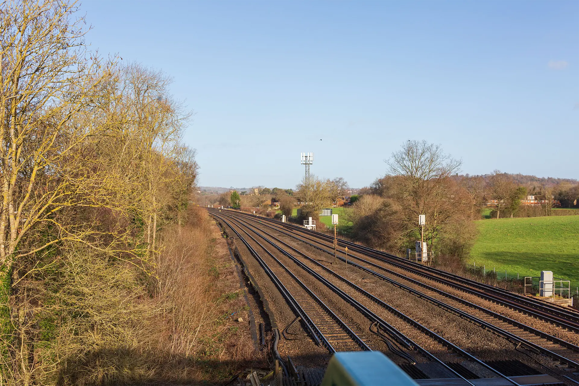
The Brighton Mainline service runs 51 miles from London to the South Coast, through some of the UK’s most densely populated areas. At the start of the project timeline, mobile internet and connectivity between London and Brighton varied from good to no connectivity at all.
This project sees new and upgraded infrastructure deployed along the entire London to Brighton railway route, with the intention of creating a seamless signal along the route and continual improvements over time.
Working for Cellnex UK, along with their various planning teams including Telligent, Planning Base, Circet UK and HF Coms, we prepared Accurate Visual Representations also known as Verified Views, and Photomontages.
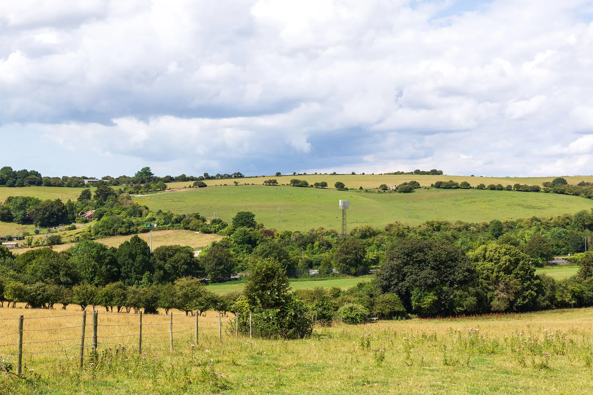
In collaboration with the various planning teams, we undertook site visits to take photographs. With our years of experience of undertaking views for LVIA, TVIA and HIA assessments, we suggested viewpoints that offered specific importance to the local areas around each site. Such as Listed Buildings, Public Right of Ways and local key viewpoints.

We undertook all photography in accordance with the Landscape Institute Technical Guidance Note.
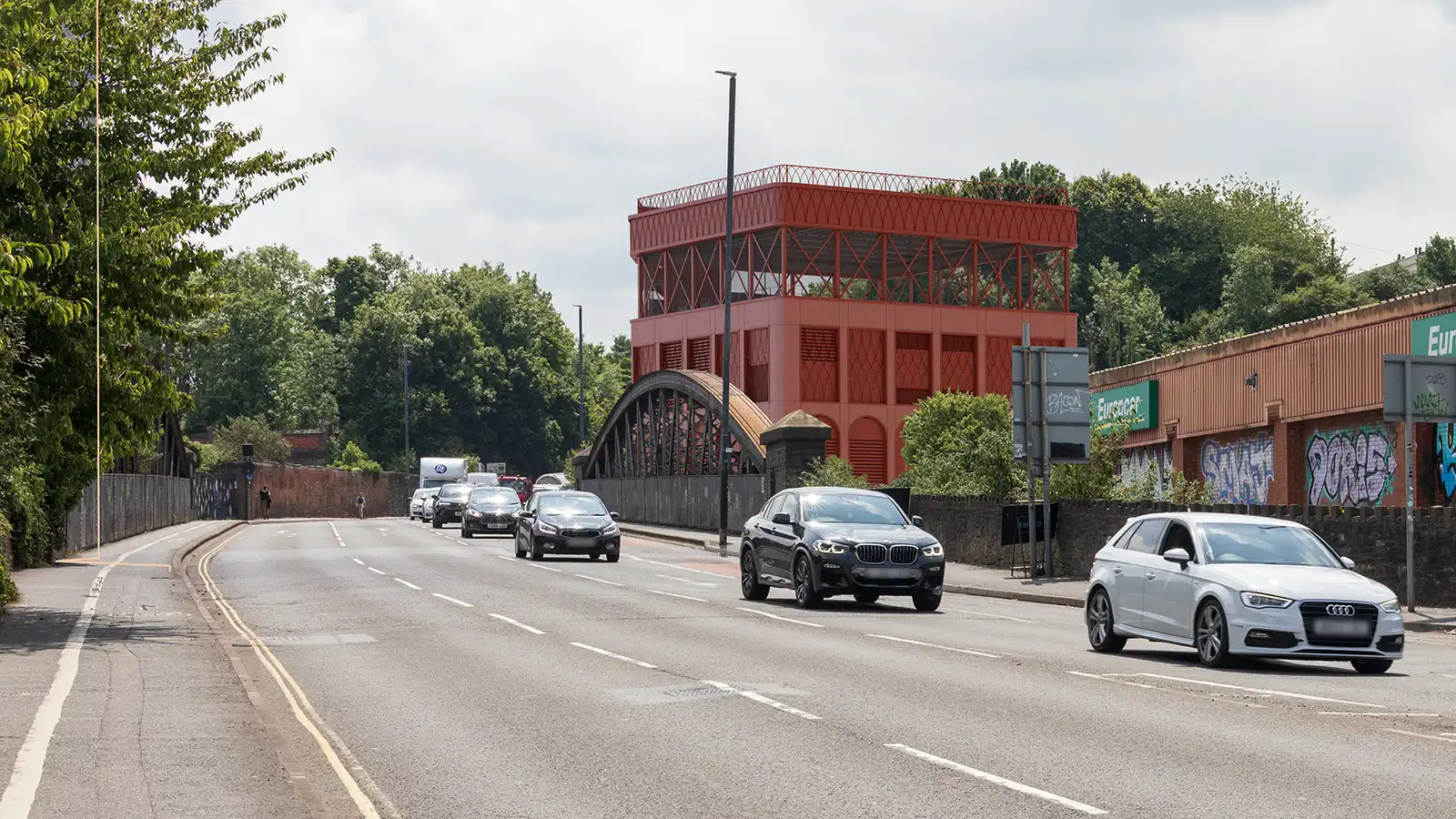
Following plans provided by Cellnex, we produced bespoke 3d models of the proposed equipment and installations. The installations vary in size and scale from location to location along the railway. From, rural locations and proposed truss tower structures. To urban locations sited on top existing buildings and structures.
In some cases, multiple proposal options were modelled to show the difference between different types of structure. These were helpful to the design team and helped deliver the right approach for each location. Further allowing them to be presented to the local authorities to show the design process when needed.

For each site we also modelled contextual information and survey information to accurately align the viewpoint photography. A selection of the viewpoints taken would then set up to check and view the change in each view. In collaboration with Cellnex and the relevant planning authorities, several views would then be selected to be presented with the planning applications.
Working in close collaboration with the sub consultants, our verified views were highly influential in delivering planning packages. We look forward to more Accurate Visual Representations work with Cellnex further into their 25-year infrastructure contract.
Our values and value-led approach to Environmental Design help you to achieve your project’s potential We get to know our clients and provide pragmatic guidance and design solutions We can be [...]
Read moreOur value-driven approach to Landscape Architecture is designed to help you realise your project’s full potential We take the time to understand your goals and provide tailored design solutions [...]
Read moreOur ecologists will help you understand the biodiversity potential of your site We will get to know your site and build a consultancy relationship that you can depend on Our ecological site surveys [...]
Read moreOur talented team will help you to understand your site’s potential and visualise it’s development opportunities We can provide you with a range of photographic and digital services to suit your [...]
Read more
Project Introduction Branna Limited needed professional townscape assessment expertise as part of a...
Understanding Heritage Impact in Bristol’s Gateway 33 Horsefair Limited sought planning...
Deeley Freed and LaSalle Investment Management needed to secure planning approval for a major...
Vattenfall UK required a Townscape and Visual Impact Assessment to support a planning application...


