May 6, 2017
Visualisation
The Landscape Institute has recently issued new technical guidance which “aims to help landscape architects, planning officers and other stakeholders to select types of visualisation which are appropriate to the circumstances”.
NPAVisuals.co.uk has been updated to provide more information relating to verified views and the types of representation available. Verified views can be created to a number of different Accurate Visual Representation (AVR) classification levels.
AVR level 0 – Location and size of proposal
AVR level 1 – Location, size and degree of visibility of proposal
AVR level 2 – As level 1 + description of architectural form
AVR level 3 – As level 2 + use of materials
See our Verified Views webpage for further information on Verified Views & AVR classifications
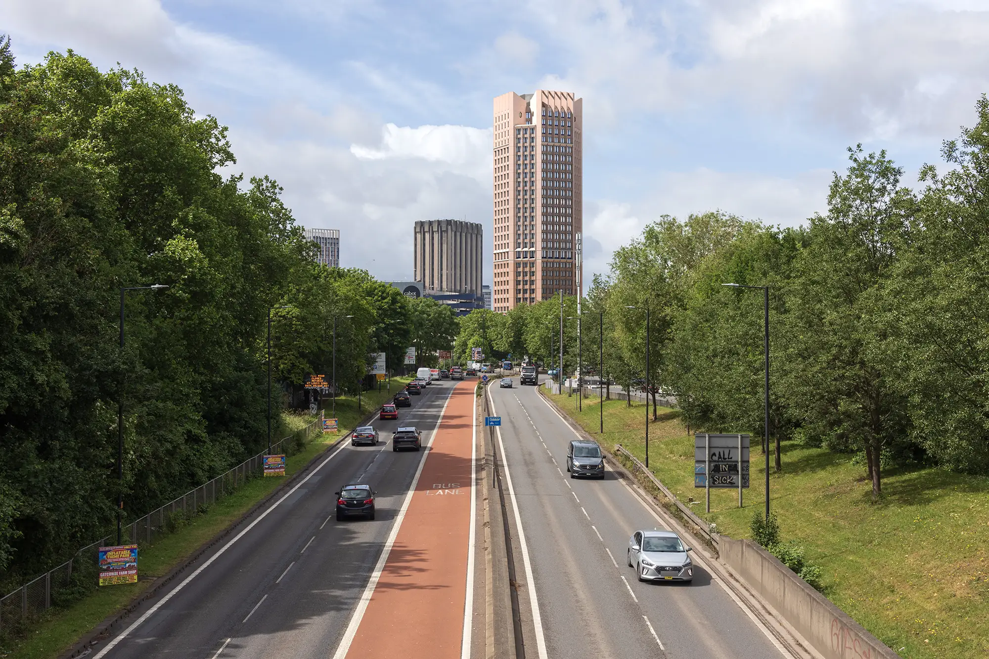
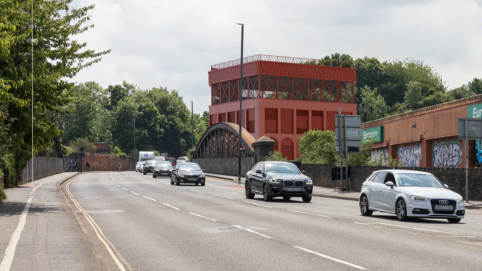
The purpose of a Verified View is to impartially represent the proposed development as it would appear in reality using a baseline of verifiable visual data and information. A Verified View combines photographic views with accurate CAD 3-D representation of the proposals to an agreed level of detail. This verifiable image, using quantifiable data, can then be used by others to scrutinise the work, if required, without its veracity being questioned.
Verified Views are also referred to as:
Visually Verifiable Montages (VVMs)
Verified Visual Image (VVIs)
Accurate Visual Representation (AVR)
The Landscape Institutes Visual representation of development proposals guidelines help identify the types of visualisation and when to implement them and NPAVisuals has a wide range of visualisation styles and experience to assist your project.