February 12, 2019
Environmental Design, Landscape Architecture
The increase in need for, and implementation of, flood risk management schemes within the UK, has potential effects on the character of associated landscapes and townscapes. We appraise some of the considerations and challenges of implementing a flood defence scheme within a well-used, popular and sensitive public open space. The role of the environmental assessment process is reviewed.
Over 5.7 million properties are at risk of flooding within the UK 1. The Environment Agency and Natural Resources Wales consider and implement a range of measures to address flood risk to communities and properties across England and Wales within rural, coastal and urban environments. They have procedures in place to assess and mitigate the environmental impacts of such schemes. This can either be through the statutory Environmental Impact Assessment (EIA) process or the preparation of non-statutory Environmental Reports.
Within urban environments where there is risk of flooding, space for interventions and mitigation can be particularly constrained. Interventions can lead to considerable impacts to local landscapes and affect a large number of people who live, work and visit the area. One such example is Roath, a central suburb in Cardiff, through which runs Roath Brook.
Many homes and businesses in the area were at risk of flooding from high river flows, high tides or a combination of both. The Roath Brook burst its banks most recently during high river flows in 2007 and 2009 and during high tidal events in 2010 and 2012. Without intervention, the likelihood of flooding would increase over time. This is due to a rise in sea levels and more frequent and intense heavy rainfall being predicted as a result of climate change.
The Welsh Government funded a Flood Risk Management Scheme (FRMS) for Roath to minimise the risk and mitigate the impact of flood events. A non-statutory Environmental Report was prepared for the scheme. Although a non-statutory document, the Environmental Report, and the EIA carried out to identify the significant environmental effects of the proposed development, was undertaken in line with the EIA Quality Mark Commitments.
The Roath FRMS, completed in autumn 2018, has increased the level of protection for the community up to a 1 in 75 chance flood event from high river flows and a 1 in 150 chance flood event from high tide levels. The scheme has reduced the flood risk to 360 homes and 45 businesses.
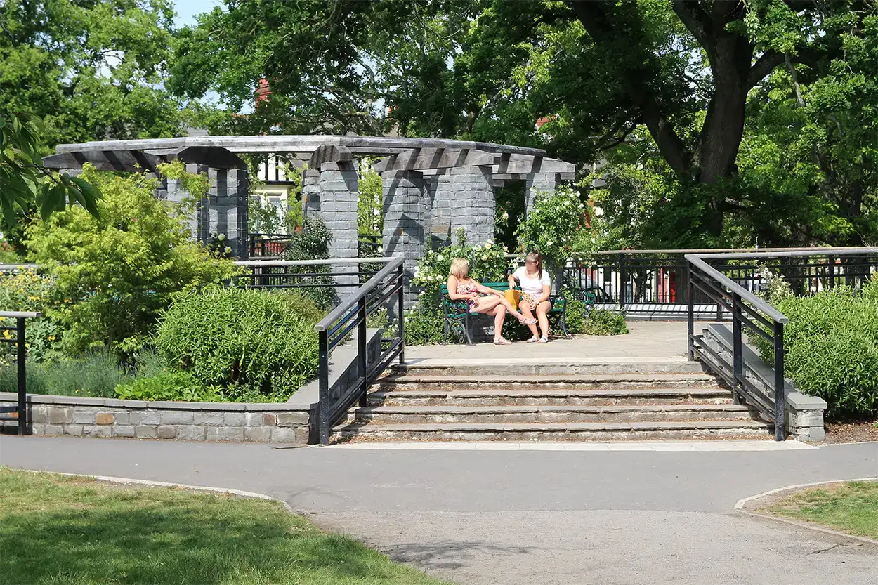
The scheme presented many design challenges as the Roath Brook flows through a series of attractive Edwardian parks which contain a collection of unusual and rare trees. The whole area is open to the public and is heavily used and highly valued. Most of the scheme is located within the Roath Mill Gardens Conservation Area, and within a Registered Park and Garden: Waterloo Gardens and Roath Mill Gardens.
The Conservation Area Appraisal states that the park is a “landscape feature of major significance to the visual amenity of the Conservation Area”. It can be viewed from almost every part of the Conservation Area.
A key design objective at the outset of, and throughout, the project was primarily to recognise the importance of the site as a public park, with the required flood protection responding to this context. The iterative environmental assessment and design process helped achieve this.
The scheme required a series of flood protection walls and embankments along both banks. These were very carefully designed to minimise landscape and visual impacts, including tree removals, whilst providing the improved flood capacity and retaining public access. Opportunities were also taken to provide additional features within the park and enhance biodiversity.
In terms of the main engineering elements, the new walls had to be sheet piled and provide 1.2m of protection. They were designed in a sinuous pattern to minimise the loss of the important trees and are clad with a combination of Welsh pennant sandstone and red brick to integrate the proposals into the parkland landscape. Local pennant stone was used for key paved areas and a new seating was added. The materials were selected through the assessment and design process to match the local building materials and design styles.
Retaining access and circulation into and through the park was a key challenge. The existing Waterloo Road Bridge had to be rebuilt with larger culverts for the flood flow. Three new pedestrian bridges with accessibility ramps over the walls were also constructed spanning the brook. In Waterloo Gardens, these were combined with a raised dais containing seating, a stone and oak pergola and planting beds to provide a new focal point within the park. An opportunity for enhanced access has also been taken with a new circulatory path added to a previously neglected part of the open space.
An element of public art and interpretation was included in the project. This comprised the installation of a scale model sculpture of a medieval mill which previously existed onsite.
In terms of tree replacement and biodiversity enhancements, over 120 trees were planted along with thousands of shrubs and bulbs. In addition, parts of the watercourse and banks were modified to allow the introduction of marginal plants. Areas within the walls are also being managed as naturalistic grassland and wild flora areas. Artificial Kingfisher nesting tunnels were included in suitable locations within the new walls.
This article was written in March 2019 as a contribution to the EIA Quality Mark’s commitment to improving EIA practice.
Reference:
- Surface water: The biggest flood risk of all. Speech by Sir James Bevan KCMG, Chief Executive, Environment Agency, CIWEM Surface Water Management Conference, 17 October 2018.